 |
| Whidbey Island map |
 |
| Deception Pass Bridge |
 |
| Carol checking out view from Deception Pass Bridge |
 |
| Looking northwest from Deception Pass Bridge |
 |
| Steve checking out view from Deception Pass Bridge |
 |
| People, boats and woody debris on Whidbey Island shore |
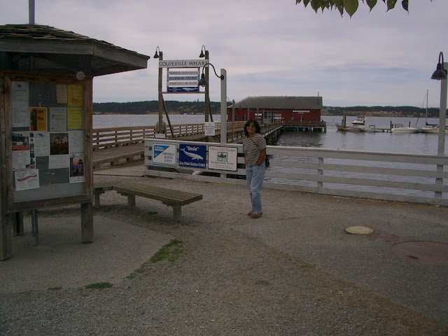
About halfway down Whidbey Island, we stopped at the historic town of Coupeville which according to Wikipedia, is one of the oldest towns in the state of Washington. The town was very quaint and exuded charm with a cool fishing wharf, art galleries, touristy shops and restaurants.
 |
| Coupeville, Whidbey Island |
 |
| Coupeville fishing wharf |
 |
| Fort Casey disappearing guns |
 |
| Admirality Head Lighthouse |
Our Whidbey Island road trip ended with a ferry ride from Clinton at the southern end of the island to Mukilteo, Washington on the mainland.
 |
| Ferry from Clinton to Mukilteo, Washington |
 |
| Ferry from Clinton to Mukilteo, Washington |
TILOTD –
- Whidbey Island is 37 miles long and 1.5 to 10 miles wide and 168 square miles making it the 40th largest island in the US
- Deception Pass Bridge consists of a pair of bridges that were added to the National Register of Historic Places in 1982.
- George Vancouver named the pass "Deception" because it had misled him into thinking Whidbey Island was a peninsula
- Sea captain Thomas Coupe was the founder of the town Coupeville and was the only man ever to sail a full-rigged ship through the Deception Pass strait.
- In the early years travelers used a ferry to cross from Fidalgo Island to Whidbey Island. To call the ferry, they banged a saw with a mallet and then sat back to wait for the ferry.
- In 1982, the Deception Pass bridge was listed in the National Register of Historic Places. Repainting the bridge cost more than the original construction cost.
- Coupeville was laid out in the 1850s by Captain Thomas Coupe, and named for him
- Coupeville was the film location for the cult classic film Practical Magic starring Sandra Bullock and Nicole Kidman.
- The second Admiralty Head lighthouse was constructed out of brick and stucco with walls thick enough to withstand earthquakes and the concussion of Fort Casey's guns.
No comments:
Post a Comment