- Mutiny on the Bounty - Author: Peter Fitzsimons
- The Solace of Open Spaces - Author: Gretel Ehrlich
- Endurance: Shackelton’s Incredible Voyage - Author: Alfred Lancing
- The Greatest Beer Run Ever - Author: John Donohue & J.T. Molloy
- Ranger Confidential - Author: Andrea Lankford
- Unbroken: A World War II Story of Survival, Resilience and Redemption - Author: Laura Hillenbrand
- The Dudes Abide - Author: Alex Belth
- How to Prepare for Climate Change - Author: David Pogue
- The World-Ending Fire: The Essential Wendell Berry - Author: Wendell Berry
- Good Clean Fun: Misadventures in Sawdust at Offerman Woodshop - Author: Nick Offerman
- The Completed Autobiography of Benjamin Franklin - Author: Mark Skousen
- Jesus and John Wayne - Author: Kristin Kobes du Mez
- Brief Answers to the Big Questions - Author: Stephen Hawking
- The Life and Times of Frederick Douglass - Author: Frederick Douglass
- Twain’s Feast - Author: Nick Offermann
- Gumption: Relighting the Torch of Freedom with America’s Gutsiest Troublemakers - Author: Nick Offerman
- Paddle Your Own Canoe: One Man’s Fundamentals for Delicious Living - Author: Nick Offerman
- Where the Deer and the Antelope Play - Author: Nick Offerman
Saturday, December 31, 2022
Book Reading List - 2022
Wednesday, December 21, 2022
Winter Solstice - Limerick
Winter Solstice has come again
Labels:
Environment,
Equinox,
Limerick,
Poem,
Solstice,
Winter Solstice
Location:
Vancouver, WA, USA
Winter Solstice - Haiku
Labels:
Environment,
Haiku,
Poem,
Solstice,
Winter Solstice
Location:
Vancouver, WA, USA
Wednesday, October 19, 2022
S.Calif Trip Day 9- Colton, CA to Pasadena, CA
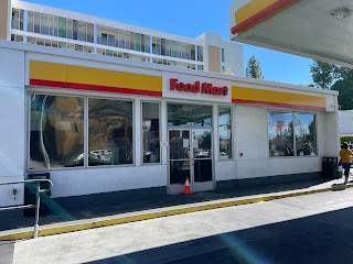
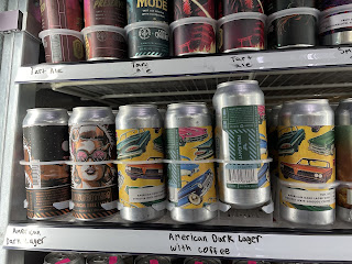
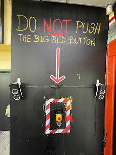
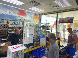
Colton, CA – Woke at around 7 AM. Weather clear 62 deg – 91 deg F. Brother in-law, Blaine found an article in the Los Angeles Magazine about a “beer cave” located in a Shell gas station in Pasadena that is supposed to be the best place in Los Angeles to buy craft beer. The article artfully described a place hidden in plain sight where only the finest craft beers could be found. Anyone who knows Blaine knows he’s a beer aficionado. So, it was a no-brainer that he would propose we take a 60-mile road trip to Pasadena and check out this mysterious beervana. The days plan was for Blaine, Elaine, Carol and me to car pool to Pasadena, acquire some craft beer, find a fast-food joint, get some food, find a park and have a picnic. We departed on our beer quest and arrived at our destination around 11:45 AM. Our destination was an unassuming Shell gas station with an ordinary looking Food-Mart in back. We ventured inside and there, in the back was a wall of refrigerators stocked with a selection of craft beer that would make any beer snob drool. The store also had a somewhat eclectic décor with images of Star Wars characters on the walls and a big sign in the back with a big red button saying “DO NOT PUSH THE BIG RED BUTTON”. I must admit, I was tempted to push the button but regretfully, I resisted. We made our selection of beer and Blaine talked with the owner and told him he had driven all the way from Riverside to check out his beer-cave. The owner was duly impressed and gave Blaine some special beers from his private stash in the back room. Feeling satisfied, we left with our beer-booty and discussed what to do next. A while back, I made a Google Map with pins of all the places I used to live and where some of my ancestors used to live. By coincidence, we happened to be near some of those pinned places.
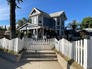
So, with a little coaxing, I was able to persuade Blaine to do a quick drive-by of a few places that were nearby (my Great Grandparents’ old house, my Grandparents’ old house., and two of my old childhood houses).
It had been a while since I’d seen the houses so of course they all looked very different. But it was nice seeing them again and it brought back lots of forgotten memories. Our next agenda item was to find food.
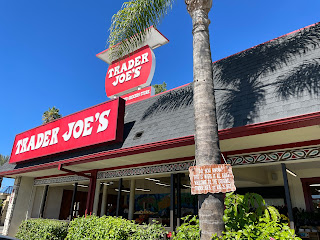
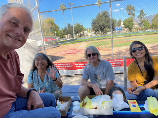
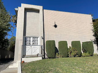
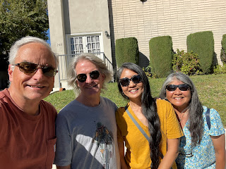
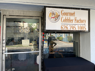
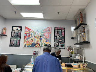
We did a Google search and found a nearby fast-food joint named Lucky Boy which, coincidently, was across the street from the first ever Trader Joe’s store .Trader Joe’s was a favorite of ours so a visit to the very first one was a must. The store had a small sign out front advertising it as the first one but otherwise, it looked like most other Trader Joe’s. We wandered around the store and bought a few “must have” items. We then went to Lucky Boy across the street and got some sandwiches which we took to a local park that, not coincidently, was next to one of my childhood schools, Allendale Elementary School. The school had been converted to an adult education learning center but otherwise looked pretty much the same. While looking at Google Map, I noticed we were only a couple blocks away from President Obama’s former residence. So, after our picnic, we walked over and took a few selfies in front of Obama’s former residence. The place was an oldish apartment building that had a plaque on the sidewalk out front saying Obama used to live there from 1980 – 1981 during his sophomore year at Occidental College. It was kind of cool to think that President Obama used to live in an apartment only a few blocks away from one of my childhood schools and houses. We made our way back to the car and Blaine and Elaine mentioned a nearby place named the Gourmet Cobbler Factory that makes amazing cobblers. So, it was a no-brainer that we needed to stop and get some gourmet cobblers to take home.The place was somewhat hidden on a small side street but as soon as we got close, the aroma of fresh baked cobbler made it hard to miss (and resist).
 |
| Great Grandparents old house |
 |
| Grandparents old house |
 |
| My families old house |
Things I Learned On This Day (#TILOTD) –
- The original Trader Joe’s opened in 1967 on the same day I was born (August 25)
- President Obama used to live in Pasadena in an apartment a few blocks away from one of my childhood schools and houses
- Cobblers vs. Pies - Cobblers only have a top crust that is "cobbled" or coarse. Pies have a smooth top crust and bottom crust
Location:
Pasadena, CA, USA
Saturday, October 15, 2022
S.Calif Trip Day 5- Cedar City, UT to Colton, CA
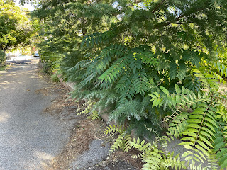
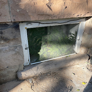
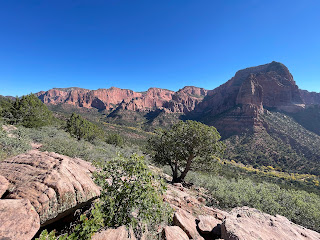
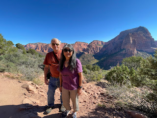
Cedar City, Utah - Spent the night at The Bard’s Inn in Cedar City, Utah. Finished packing and went to breakfast at 8:30 AM. I talked with owner of the B&B about how she should try to eradicate the Tree of Heaven (Tree From Hell) I noticed growing on her property before it spreads and potentially causes damage to her house. The tree was growing all the way down her driveway and beside the house foundation and was even growing inside her basement window. She said she didn’t realize what it was and about six months ago, she had an arborist cut them down but they had already grown back! I told her they may be almost impossible to get rid of and, unfortunately, she may need to use Roundup. We continued our road trip south on Interstate 15 and took a detour through the Kolob Canyons district of Zion National Park. There was a sign blocking the road saying visitors were required to stop at the visitor center to purchase a $35 pass before entering the park. Thankfully, several years ago when I became eligible,I purchased a Senior National Park Pass which covers entry to all National Parks and public lands nationwide. So, we didn’t need to pay for a park pass. However, we more than made up for it by buying books, maps and other National Park stuff. I talked with the ranger about what we should see and he recommended we at least drive to the Kolob Canyons view point and hike the trail to the Timber Creek Overlook where he said there’s a spectacular view of the canyon. He also added it’s very popular so parking would be tight. The Timber Creek Overlook trail was an easy hike and the view was truly amazing.
Things I Learned On This Day (#TILOTD) –
We continued our road trip and stopped for coffee and a pee break in St. George, Utah. It be had been a while since I had last seen St. George and, to say the least, it had grown a bit. I later Googled "Where does St George" and wasn't too surprised when Google completed the sentence with "get its water". According to sources, the population of St George is projected to grow from 195,200 in 2022 to 425,700 in 2060 even though its single water source, the Virgin River basin is dwindling and the west remains locked in the worst drought in 1,200 years. We continued on through the seemingly endless desert across the northwest corner of Arizona and into Nevada where we eventually could see the Las Vegas skyline looming in the distance.
Like St. George, Las Vegas had grown a bit since the last time I had driven through but I wasn’t really prepared for how huge it had become. The traffic and enormous casinos seemed ridiculously out of place and just when I thought it couldn’t get worse, Trump’s gold casino appeared 😱We continued on and made another gas and pee stop in Primm, Nevada. Accordiing to Wikipedia, Primm was previously known as State Line but the name was changed to Primm in 1996 to avoid confusion with Stateline in northern Nevada. Its economy is primarily based on Southern California gamblers wanting to stop before reaching Las Vegas 40 miles away. Something that surprised me while going through Primm was the number of Tesla charging stations and the effort being made by Tesla and Elon Musk to facilitate travel to and in Las Vegas in a Tesla. We continued our road trip and surprisingly ran into rain with thunder and lightning near Barstow, California. The rain with the addition of fog and heavy traffic made the drive over the Cajon Pass even more exciting than usual. Thankfully, drivers were being surprisingly cautious and after a quick stop for food, we made it to Colton, California by around 6 PM.
Things I Learned On This Day (#TILOTD) –
- St. George, Utah is one of America's fastest growing metro areas
- According to Last Week Tonight with John Oliver, Utah and St. George residents use the most water of any western state.
- Tesla is building the world’s largest supercharging station in Barstow, California
- Elon Musk's Boring Company has been working to build a system of tunnels underneath Las Vegas
Location:
Cedar City, UT, USA
Friday, October 14, 2022
S.Calif Trip Day 4- Cedar City, UT to Parowan Gap, UT
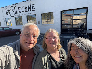
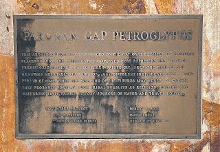
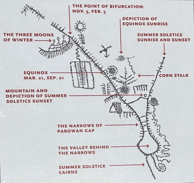
Cedar City, Utah - Spent another night at The Bard’s Inn in Cedar City, Utah. Woke at 7 AM MT and started getting ready to leave but then decided Carol and I would spend another night at The Bard’s Inn. We all went to breakfast at 8:30 AM MT and I verified our room was still available that night. After breakfast, we treated Lotte to coffee at the Bristlecone Café before she left to go back to Grand Junction, Colorado to visit other friends. After saying good bye to Lotte, we drove to Parowan Gap to check out the petroglyphs and dinosaur tracks. The petroglyphs were awesome and, IMO rivaled the petroglyphs I'd seen at Newspaper Rock State Historic Monument. According to the information signs at Parowan Gap, the petroglyphs were the works of people from the prehistoric Fremont and Southern Paiute cultures thousands of years ago.
The petroglyphs were their written language and were based on Indian sign language that was universal among all tribes throughout North America. The petroglyphs also helped them record astronomical knowledge and researchers believe the Indians who came to this site found Parowan Gap’s geological features offered a means to chart seasonal and celestial movements.
Things I Learned On This Day (#TILOTD) –
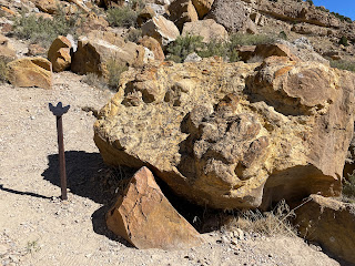
After viewing the petroglyphs, we drove a few miles up the road to where the dinosaur tracks were located. According to the information signs, the tracks were created by Hadrosaurs who were one of the most plentiful dinosaur species in North America 65 to 75 million years ago. Hadrosaurs were “duck billed” plant eaters who weighed a few tons and were 10 – 40 foot long. The footprints were left when they walked through mud which was eventually filled with pebbles and sand and over time, was covered and hardened into rock. Over millions of years, erosion eventually brought the rocks and footprints to the surface where they’re visible today. We walked around the site looking for footprints and eventually found several that had small, metal footprint symbols next to them. The actual footprints were not obvious and if they weren’t marked, I’m not sure I would have seen them. Sadly, someone actually broke off a piece of one of the footprints making it even harder to recognize. We continued our road trip to the town of Parowan which is a small, quaint town of about 3,100 people and used to be the Iron County seat. We drove by the Old Rock Church that was built in 1867 out of yellow sandstone from nearby canyons. We then stopped at a local drive thru and got root beer floats before heading back to Cedar City where we finished the previous night’s left-over pizza and then walked over to the nearby Southern Utah University where we checked out the new Shakespeare theater and Shakespeare character sculpture garden.
Flash Back to July 1995 - While on our way home from a road trip to Canyonlands National Park, our 1989 Isuzu Trooper blew a head gasket about 40 miles north of Cedar City, Utah. We were in the middle of nowhere but thankfully, we were on Interstate 15 where, hopefully, we would be more likely to get help (there were no cell phones back then). We waited for a long time and finally saw a highway patrol car approaching and thought all was good. But, unbelievably, he drove by without stopping. We watched him drive away thinking evil thoughts but then saw him exit the freeway and park about ½ mile up the road. I wasn’t sure why he stopped but decided to try catching him before he drove away. When I finally got to his car, I saw that he was sound asleep. So, I tapped on the window hoping he wouldn’t shoot me. He woke up with a start and asked what I wanted. I explained our situation and he agreed to drive us to the nearest gas station about 15 miles up the road in Beaver, Utah. I talked with the gas station owner in Beaver and arranged to have our car towed to the gas station where he quickly diagnosed it as having a blown head gasket. He said we MIGHT be able to get it repaired at a local garage but, since it was the weekend before 4th of July, he wasn’t sure. So, I called the garage and amazingly they said they would try to fix our car. Unfortunately, that meant we would be stranded in Beaver, Utah for about 5 days with no car and no place to stay. Unbelievably, the gas station owner said he would lend us his car while our car was being repaired. He also recommended we drive down to Cedar City where we could find a motel. At that time, we knew nothing about Cedar City but didn’t have many options. So, we drove about 1 hour south to Cedar City and found a cheap motel. By dumb luck, it turned out Cedar City was having its annual Shakespeare Festival. I hardly remember anything we did while stranded in Cedar City but I will always remember seeing The Tempest with Prospero played by Harold Gould. Now, twenty-seven years later, it was interesting seeing how much Cedar City has changed and how it has become famous for its Shakespeare Festival.
 |
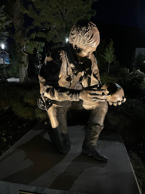 |
| Hamlet sculpture at SUU |
Things I Learned On This Day (#TILOTD) –
- Archaeoastronomy is the investigation of the astronomical knowledge of prehistoric cultures
- Hadrosaurs were one of the most plentiful dinosaur species in North America 65 to 75 million years ago.
- Cedar City is famous for its annual Shakespeare Festival.
Location:
Cedar City, UT, USA
Thursday, October 13, 2022
S.Calif Trip Day 3- Cedar City, UT to Cedar Breaks National Monument
CedarCity, Utah - Spent the night at The Bard’s Inn in Cedar City, Utah. Woke at 7 AM MT and showered. At 8:30 AM MT, Lotte, Carol and I went to dining room where the B&B owner, Susan had prepared breakfast of sausage, frittata (egg & potatoes), fruit, OJ, pastries, coffee, etc. I was interested in checking out a local rock shop. So, after breakfast, we drove to the nearby Cedar Rock and Bead Shop where we spent about 30 minutes looking at their huge collection of rocks and beads. Lotte and Carol spent time looking at the beads while I checked out the rocks. The store also had an interesting collection of plants for sale. There was a huge collection of rocks upstairs and I was somewhat amused and dumbfounded by a sign on one of the shelves that said “If you are caught licking any of the merchandise in the store, you will be required to purchase the items and you will be banned from the store”. Apparently there have been enough cases where people have licked the halite (salt) rocks to see if they taste like salt to justify posting a sign 😂. I resisted licking any rocks and ended up buying some petrified wood and locally collected agate that I wanted to tumble and give as gifts. Carol also bought a few rocks for gifts and Lotte bought some beads she said she would use to make some custom bookmarks. Before leaving, I asked the owner how he got into the rock, bead and plant business and he said it was just a hobby that became a business.
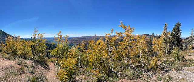
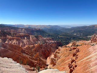
After leaving the rock shop, we drove to CedarBreaks National Monument east of Cedar City, Utah. While driving on Hwy 14, we stopped at a beautiful vista point where we took some photos and selfies. The view was amazing and with the help of the info signs, we could actually identify Zion National Park in the distance. While we were at the vista point, there was a guy with an antenna and some tracking gear. We asked what he was doing and he said he was trying to locate CaliforniaCondors that had been tagged with radio tracking devices. His name was C.J. and he said he was a biologist who works for The Peregrine Fund which is a non-profit organization that is trying to conserve threatened and endangered birds of prey worldwide. He said in 1987 California Condor essentially went extinct in the wild when the remaining 27 wild condors were captured and taken to the San Diego Wild Animal Park and the Los Angeles Zoo to attempt breeding them in captivity. Thankfully, through the captive breeding program, biologists have been able to reintroduce Condors to the wild and there are now approximately 500 living in the wild or captivity. C.J.s enthusiasm for the program was so positive that we all pledged to donate to the fund as soon as we can. We continued our road trip and somehow missed the Hwy 148 turnoff to Cedar Breaks National Monument and didn’t realize it until we came to the end of Hwy 14. We turned around and retraced our route and, but for a very inconspicuous sign, we almost missed the Hwy 148 turnoff again!The visitor center and main overlook were under renovation so we weren’t able to stop there. However, we were able to see several other overlooks with amazing views of the canyon below. According to Wikipedia, “breaks” are a form of badlands composed of steep canyons, spires, walls, and cliffs. The name “Cedar Breaks” was given to the area by early settlers who combined the word “breaks” with “cedar” based on the many juniper trees (incorrectly called cedars) that grow in the area. After taking a few photos, we drove a few miles back to a picnic area where we enjoyed some snacks and drinks. We returned to The Bard’s Inn and a little later, walked a couple blocks down the street to Centro Woodfired Pizzeria where sweet Lotte treated us to dinner. We each got a single serving pizza with the idea that we would all share. The place was jammed with young college aged kids out for the night. After dinner, we walked up to Main Street and checked out some of the shops. Many of the shops had signs advertising the CedarLivestock and Heritage Festival scheduled for the end of October. According to the signs, the highlight of the festival is the sheep parade where approximately 1,000 sheep are herded from Cedar Mountain pastures down Cedar City’s Main Street. The parade also includes horses, wagons, antique tractors, bag pipe bands, youth groups, and stock dogs. We then returned to the Bard’s Inn where we chatted and sipped vino before hitting the hay.
Things I Learned On This Day (#TILOTD)
Things I Learned On This Day (#TILOTD)
- California Condor have been brought back from the brink of extinction due to captive breeding programs and groups like The Peregrine Fund
- Cedar City has an annual sheep parade
Location:
Cedar City, UT, USA
Wednesday, October 12, 2022
S.Calif Trip Day 2- Jerome, ID to Cedar City, UT
Best Western Sawtooth Inn & Suites, Jerome, Idaho – Woke around 7:30 AM MT. Went to the front dining room and had a complimentary breakfast of omelets (made to our specs), toast, coffee, etc.
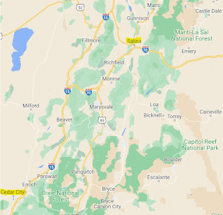
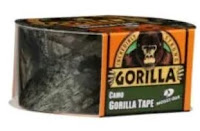
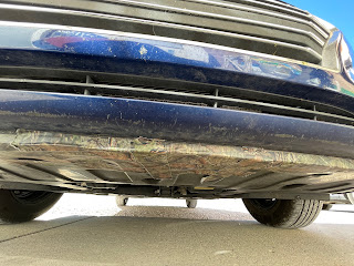
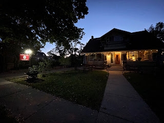
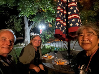
I started getting a sore throat yesterday and was feeling worse. Took a COVID-19 quick test and thankfully it was negative. We walked across the street to a Walmart and got some cold medicine (Dayquil & Halls Throat Lozenges). We then packed up and continued our road trip to Cedar City, Utah where the plan was to meet Lotte at the Bard’s Inn B&B. Lotte called around 3 PM and said she was having car problems. She said her Alamo rental car (Hyundai Accent) was making a loud flopping noise when she went over 45 MPH. She was near Salina, Utah and said she would go there to see if she could find a garage to look at the car. Luckily, we were on Interstate 15 just north of Highway 50 that goes to Salina, Utah. So, we decided to go to Salina and see if we could help. Took about ½ hour to reach Salina. We didn’t have any cell service so weren’t sure where Lotte would be. But we spotted a garage and sure enough, there was Lotte. We tooted our horn and laughed at how strange it was meeting in a place like this out in the middle of nowhere. Lotte and I went into the garage to see if they could check her car and the lady at the counter looked at us like we were crazy and said they wouldn’t be able to look at it for at least three weeks! So, I asked Lotte if I could take her car for a test drive. I drove the car and sure enough, when I reached around 45 MPH, the car started making a terrible noise that sounded like one of the wheels was falling off. I stopped and looked under the front of the car and discovered the engine shield had broken loose causing it to scrape the ground when the car went over 45 MPH. I told Lotte what the problem was and suggested we get some duct tape and tape the shield onto the car body. So, we went to a nearby hardware store and got some duct tape. I recommended we use Gorilla brand duct tape and Lotte noticed they had Camo Gorilla tape and decided she needed to splurge for that. The front of the Hyundai Accent had about 6 inches clearance. So we decided to pull the front of the car up onto the curb in front of the hardware store where we might have better access. A passer-by suggested we use a jack but we’re stubborn and felt we could do it without jacking the car up. So, we both got down on our hands and knees and taped the loose shield to the front of the car. We then crossed our fingers and continued our road trip to Cedar City, Utah. Amazingly, the tape held perfectly and Lotte was even able to go the speed limit (80 MPH) with no problems.We arrived at The Bard’s Inn B&B in Cedar City around 7 PM. It was dark and The Bard’s Inn B&B looked very cozy from outside. Our accommodations included a kitchen, bathroom and two very tiny bedrooms.We checked in and treated ourselves to snacks of smoked salmon, cheese, salami, bread, vino sitting outside in the front yard while enjoying the beautiful Utah fall weather.Things I Learned On This Day (#TILOTD) -
- Gorilla Duct Tape is an essential on all road trips (camo color is optional 😂)
Location:
Jerome, ID 83338, USA
Subscribe to:
Comments (Atom)







.JPG)
